
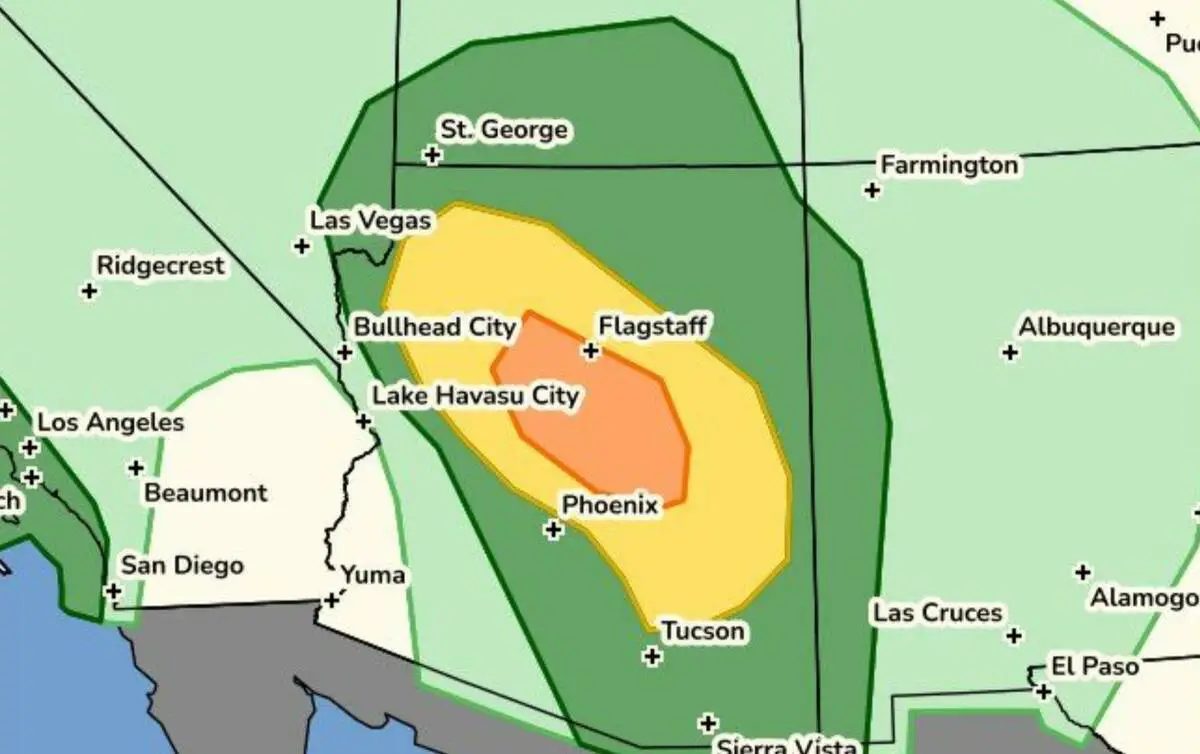
A strong storm system moving in from the Pacific is pushing a surge of moisture into the Southwest, prompting the National Weather Service to warn of hazardous conditions across Arizona and Utah on Wednesday and Thursday. Forecasters expect periods of widespread showers and thunderstorms, with the greatest risk peaking Wednesday afternoon and evening before potentially continuing into Thursday morning.
A flood watch is in effect for most of Arizona through Thursday. The Salt Lake City weather office has issued a high risk of flash flooding for many southern Utah parks and recreation areas, urging travelers to strongly consider altering plans to avoid normally dry washes, slot canyons, streams, backcountry roads, and low water crossings.
Severe thunderstorms are forecast across Arizona and the Four Corners region, bringing threats of large hail up to two inches in diameter, damaging winds, frequent lightning, and possible tornadoes. The weather service noted a potential desert tornado outbreak Wednesday afternoon affecting areas including Phoenix, Flagstaff, and southern Utah.
Rainfall totals of 1 to 3 inches are expected widely, with a 10 percent chance of 3 to 5 inches across the Grand Staircase region. Eastern Utah could see 1 to 2 inches, with a similar chance of 2 to 3 inches in the Castle Country area.
Sources: Las Vegas Review-Journal
Original reporting: Las Vegas Review-Journal →



 English (US)·